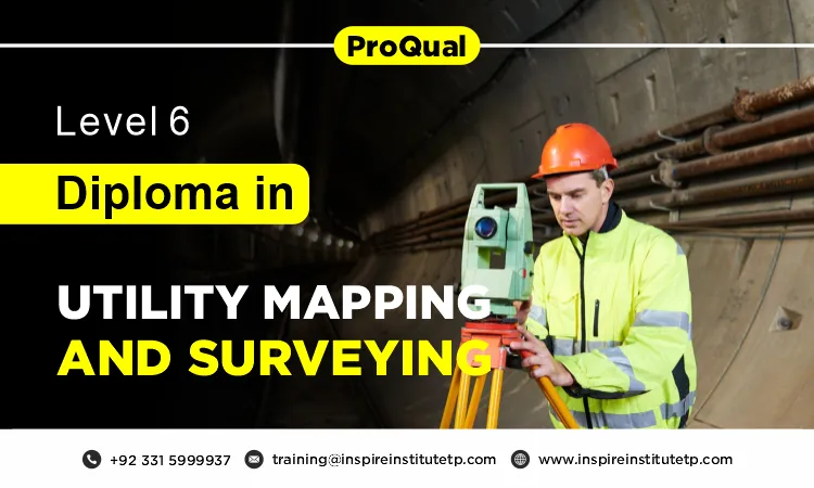
ProQual Level 6 Diploma in Utility Mapping and Surveying
The ProQual Level 6 Diploma in Utility Mapping and Surveying is a specialized qualification designed for professionals in the surveying and construction sectors. This course equips participants with advanced skills and knowledge required to effectively map and manage utility infrastructure. Ideal for those seeking to enhance their expertise and career prospects, the diploma covers a broad range of topics essential for modern utility mapping practices. The ProQual Level 6 Diploma typically spans several months, allowing for a blend of theoretical learning and practical application. Participants can expect a mix of classroom instruction, hands-on training, and independent study.
Graduates of the ProQual Level 6 Diploma in Utility Mapping and Surveying are well-positioned for a variety of roles, including utility surveyor, GIS technician, project manager, and consultant within construction firms, utility companies, and environmental agencies. The ProQual Level 6 Diploma in Utility Mapping and Surveying is an invaluable credential for professionals looking to enhance their skills and career opportunities in a rapidly evolving field. By completing this diploma, participants gain not only technical expertise but also the confidence to tackle complex utility mapping challenges in diverse work environments.
Why Choose this Qualification
Choosing the ProQual Level 6 Diploma in Utility Mapping and Surveying is a strategic decision for professionals eager to enhance their expertise in a vital area of the construction and engineering sectors. This qualification offers comprehensive training in utility mapping and surveying techniques, emphasizing the latest technologies and methodologies. Participants will gain essential skills to accurately locate and map underground utilities, ensuring safety and efficiency in construction projects. This specialized knowledge is crucial for navigating the complexities of modern infrastructure.
One of the standout benefits of this diploma is its industry recognition. As a nationally accredited qualification, it enhances your professional credibility, signaling to employers your commitment to high standards in utility mapping and surveying. Holding this qualification can significantly improve your employability, making you a more attractive candidate in a competitive job market.
The diploma also opens up numerous career advancement opportunities. With the ongoing growth of infrastructure development, the demand for skilled professionals in utility mapping and surveying continues to rise. Completing this course positions you for advanced roles and specialized positions, enabling you to take your career to the next level.
The ProQual Level 6 Diploma in Utility Mapping and Surveying is an excellent choice for professionals seeking to advance their careers. With its focus on specialized knowledge, industry recognition, practical skills, and networking potential, this qualification equips you to meet the demands of a dynamic field while positioning you for future growth and success.
Course Overview
Ofqual Regulated Qualification
Course Level: Level 6
Average Completion Time:
6-18 Months
Mandatory Units: 5 Mandatory Units
Evidence & Assignment Based

Inspire Institute of Technologies is Approved Satellite Centre of ProQual
Qualification Structure
The ProQual Level 6 Diploma in Utility Mapping and Surveying, achieve the qualification candidates must achieve all of the mandatory units:
Mandatory Units
| Unit Title | Unit Level |
| Agree project requirements and plan site surveying in geomatics and site surveying management | 6 |
| Manage the analyses and presentation of site surveying information in geomatics and site surveying management | 5 |
| Identify, assess and present spatial data in geomatics and site surveying management | 6 |
| Vacuum excavations | 4 |
| Identify hazards and control risks in geomatics and site surveying management | 5 |
Who Should Take This Course
The ProQual Level 6 Diploma in Utility Mapping and Surveying is suitable for a variety of professionals seeking to enhance their skills and knowledge in this critical field. Here are the key groups who would benefit from this course:
- Current Surveyors: Professionals already working as surveyors who wish to expand their expertise to include utility mapping techniques.
- Construction Managers: Individuals involved in overseeing construction projects who need a solid understanding of utility mapping to ensure safe and efficient operations.
- Engineers: Those in engineering roles, particularly civil or structural engineers, who require knowledge of underground utilities for project planning and execution.
- Project Managers: Professionals managing projects that involve infrastructure development, where accurate utility mapping is essential to avoid costly disruptions.
- Utility Asset Managers: Individuals responsible for managing and maintaining utility assets within public or private sectors, ensuring they can effectively identify and manage underground utilities.
- Career Transitioners: People looking to transition into the utility sector who want to formalize their practical experience with a recognized qualification.
- New Entrants: Individuals aspiring to start a career in utility mapping and surveying, providing them with a comprehensive foundation to enter the field confidently.
This diploma is designed for surveyors, construction managers, engineers, project managers, utility asset managers, career transitioners, and new entrants who want to advance their qualifications and career prospects in the dynamic field of utility mapping and surveying.
Course Benefits
The ProQual Level 6 Diploma in Utility Mapping and Surveying offers numerous advantages for professionals in the field. Here are the key benefits:
- Specialized Expertise: The diploma equips candidates with in-depth knowledge of utility mapping techniques and technologies, enhancing their expertise in this critical area of surveying.
- Industry Recognition: As a nationally accredited qualification, this diploma is recognized by employers and industry professionals, increasing your credibility and marketability in the job market.
- Career Advancement: Holding this qualification can open doors to advanced roles in surveying, construction management, and infrastructure planning, helping you progress in your career.
- Enhanced Employability: The specialized skills acquired through this course make graduates more attractive to employers, who are increasingly seeking professionals with expertise in utility mapping.
- Practical Skills Development: The curriculum emphasizes hands-on learning, ensuring that you can effectively apply theoretical knowledge to real-world situations, enhancing your confidence in the field.
- Networking Opportunities: Enrolling in the diploma program provides access to a network of industry professionals, peers, and trainers, fostering valuable connections that can lead to job opportunities and collaborations.
- Safety and Compliance Awareness: The course covers essential safety protocols and legal requirements, equipping you to manage projects with a focus on minimizing risks and ensuring compliance.
- Flexible Learning Options: Many training providers offer flexible delivery methods, including online and blended learning, allowing you to balance your studies with work and personal commitments.
- Contribution to Infrastructure Development: By mastering utility mapping techniques, you play a crucial role in ensuring the success of construction projects, contributing to the overall safety and efficiency of infrastructure development.
In summary, the ProQual Level 6 Diploma in Utility Mapping and Surveying provides specialized expertise, industry recognition, career advancement opportunities, and practical skills development, making it a valuable investment for professionals in the surveying and construction sectors.
Eligibility Criteria
By ensuring these steps are taken, candidates can better prepare for the qualification and maximize their learning experience.
Educational Background:A minimum of a Level 5 qualification in a relevant field, such as surveying, engineering, or a related discipline. Alternatively, substantial professional experience in surveying or utility mapping may be considered.
Professional Experience:Relevant work experience in surveying, utility management, or a related sector is highly desirable. Candidates should have a foundational understanding of surveying principles and practices.
Technical Skills:Familiarity with surveying tools and technologies, including GIS software and data collection methods, is advantageous but not mandatory.
Mathematical Competence:A basic understanding of mathematics and analytical skills is required, as these are essential for data analysis and interpretation in utility mapping.
Communication Skills:Strong verbal and written communication skills are necessary for effective collaboration with team members and stakeholders, as well as for report preparation.
Commitment to Professional Development:An eagerness to engage in continuous learning and professional growth within the utility mapping and surveying field.
The Qualification Process
Here is a step-by-step guide to help you understand the entire journey from pre-registration to certification:
- Self-Assessment:
Begin by evaluating your eligibility for the course. Ensure you meet the entry requirements, such as relevant qualifications or professional experience, as outlined for the program. - Registration:
Complete your registration by submitting the required documents, including a scanned copy of a valid ID, and pay the necessary registration fee. This is your first official step in the qualification process. - Induction:
An assessor will conduct an induction session to verify your eligibility and introduce you to the evidence requirements. During this stage:- If the assessor finds that you meet all the necessary criteria, you will proceed to the next step.
- If you do not meet the entry requirements, your registration will be canceled, and your fee will be refunded.
- Evidence Submission:
Based on the assessment criteria, you will need to submit evidence demonstrating your knowledge and competence. Consult with your assessor if you need clarification on the type and nature of the evidence required. This evidence could include assignments, projects, case studies, or professional experiences related to sustainability management. - Feedback and Revision:
The assessor will review your submitted evidence and provide feedback. Evidence that meets the required criteria will be marked as “criteria met.” If there are any gaps, the assessor will highlight them, and you will need to address those gaps by revising and resubmitting the evidence. - Competence Evidence:
Submit your final evidence demonstrating that you have successfully achieved all the learning outcomes. The assessor will mark your submission as “Criteria met” once everything is up to standard. - Internal Quality Assurance (IQA):
After your evidence is approved by the assessor, the Internal Quality Assurance Verifier (IQA) will review it to ensure that the assessment was carried out consistently and according to ProQual standards. - External Verification:
The IQA then presents your portfolio to ProQual External Quality Assurance Verifiers (EQA) for final confirmation. The EQA may contact you directly to verify the authenticity of your evidence. - Certification:
Once all internal and external checks are completed to satisfaction, ProQual will issue your official certificate, confirming that you have successfully achieved the qualification.
This comprehensive process ensures that learners demonstrate all necessary competencies and meet the high standards required for the ProQual Level 6 Diploma in Hostile Environment Operations.
